Showing posts with label ruins. Show all posts

Saturday, November 10, 2018

A Walk Around Maridalsvannet

From City to Lake

Dam and bridge over the Akerselva at Brekkedammen park near Kjelsås.

With the end of daylight savings time, the days have quickly gotten much shorter. By 16:15 the sun has set, making the rare moments of sunshine all the more precious.

Path around Maridalsvannet.

Lately, we've had a lot of rainy days in Oslo. Last Saturday, I had to take advantage of the decent weather and daylight by going hiking to check out a new area. It was only 37-39˚ F, so I put on my layers and headed out.

A garden 'deer' near Maridalslvannet. 

I really didn't have any plans where I was headed for the morning. I just started walking and ended up wandering along the Akerselva north towards Kjelsås. I walked through Brekkedammen park and then decided to explore the area around Maridalsvannet.   

Forest pathway.

Normally Brekkedammen park would lead directly to the lake, but currently there is on-going construction to drill a new tunnel into the side of the mountain. Fortunately, there is a path that goes up and around the construction site and turns into beautiful hiking trails.
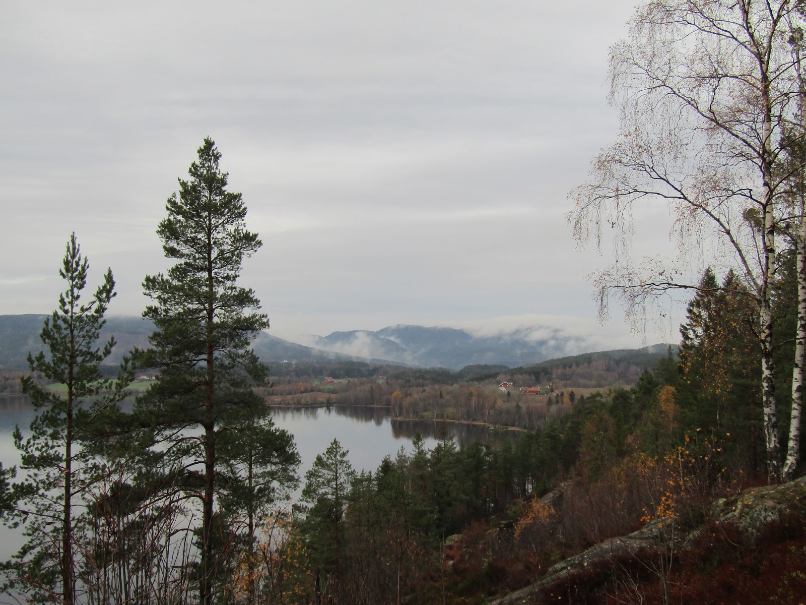
Looking northwards over Maridalsvannet.

Oslo has 170,000 acres of forest parks in the municipality, meaning there are lots of places a short trip from the city center to go hiking.  It was about a 45 min walk from where I live to Maridalsvannet, but it is also easily accessible by tram or bus. 

The north end of Maridalsvannet.

It was my first time walking around Maridalsvannet, which is the largest lake in Oslo. Maridalsvannet stands for Lake Maridal, and is Oslo's main drinking water source. Everywhere you walk there are signs warning that the lake contains our drinking water, so most all activities are prohibited to protect it.

Photo-op by Maridalsvannet.

I actually didn't even notice any areas where you could go down to the shoreline, but of course there are lots of little streams carrying water down into the lake.  No complaints though, because the views looking down across the lake were breathtaking.

Approaching Sander Gård.

As you follow the trail along you come to Sander Gård, or Sander's Farm. The area was first mentioned in texts dating back to 14th century, where the farm was originally divided between one church and monastery. In 1726, Sander Gård grew into a single farm, and was later purchased by the Nordmarka estate in 1806.

The fields of Sander Gård.

Today, the farm has a central house and a couple of barns surrounded by sprawling fields.  In some areas, the fields run all the way down to the lakeside.   

View of a river that feeds in Maridalsvannet.

Once you pass through Sander Gård, the hiking path disappears and becomes a road. This road then goes the remainder of the way around the lake and back into Oslo. Unfortunately, there are no sidewalks on the road, but quite a few other walkers and bikers travel this way.

View of the lake from Nes Gård.

Just around the corner from Sander's farm is Nes Gård, or Nes' farm.  Just like Sander's farm, Nes' has been mentioned in texts since the 1300s. It too belonged to the church and was also split amongst private owners. In the late 1700s ownership once again changed hands, before becoming part of the Nordmarka estate in the 1800s.

The fields of Nes Gård beside the lake.

To protect Oslo's drinking water, the city purchased the farm in 1923. Since then, several farmers have occupied and worked the land.

Margaretakirkeruinen (Ruins of St.Margaret's Church).

Margaretakirken or St. Margaret's Church was built around 1250. The church is named after Margaret of Antioch, who is the patron saint for pregnancy and childbirth, peasants, exiles, etc. The church was widely used until the Black Death which killed 3/4 of Oslo's population in 1350. During the 1500s, services were held in the church only a few times a year. The last service took place in 1643, leaving the place to fall to ruins.

Side view of Margaretakirkeruinen.

In 1934, archaeologist Gerhard Fischer began the church's restoration efforts. Despite being relatively small and still in ruins, St.Margaret's is considered one of Oslo's best preserved medieval buildings.

Maridalsvannet.

As it was coming up on 3pm, I decided it was time to try to get home before the sun set. I walked 3/4 around the lake, but since it was getting dark and the only place to walk was on the road, I didn't want to take my chances by walking much further. I had a little walk down to Hammeren where finally I found a bus stop that would take me back into Oslo.


River flowing down from Hammeren towards the lake.

It was a long, but beautiful walk. If only they had trails along the western side of the lake I would have walked the remainder of the way home. As I was waiting for the bus, I took a look around Hammeren which also has lots of hiking trails. Can't wait to explore more!

Saturday, October 20, 2018

Gamle Oslo: exploring the old & the new

Ruins & Modern Sculptures

Ruins of St.Hallvard's Cathedral.

This afternoon I headed out to the district of Gamle Oslo, otherwise know as Old Oslo to take in the sights and stretch my legs. Gamle Oslo is located on the eastern side of Oslo, but also includes several islands in Oslofjord.

Ruins of St.Hallvard's Cathedral.  

St.Hallvard's was Oslo's first cathedral built in the early 1100s. The cathedral is named for Oslo's patron saint, St.Hallvard, who passed away in 1043.

Ruins of St.Hallvard's Cathedral.

Historically, the cathedral was used for royal weddings, burials, and as an important site of pilgrimage. For over 500 years St.Hallvard's was an important religious center for eastern Norway.
  
Ruins of St.Hallvard's Cathedral.  

The cathedral received larger additions over the years, but in 1639 was replaced by the Church of the Holy Trinity in Christiania Square. Following the arrival of the new church, the cathedral had a fire but was later rebuilt. However, over time St.Hallvard's fell out of use and deteriorated.  Stones from the cathedral were later used to make Akershus Fortress. 

 Aerial view of eastern Oslo.

Nearby the ruins of St.Hallvard's is Ekbergparken, home to a sculpture park, ancient ruins, and breathtaking views of Oslo and Oslofjord.

Branches.

Getting to Ekebergparken is easy. You can walk from the city center, or take tram #18 or #19. From one end of the park, you can take the "Mesolithic Climb," which is a hike to the top, with historical placards along the way, to learn how the landscape has changed since the last ice age. 

Ace of Diamonds by Lynn Chadwick. 

Ekeberg means oak mountain, but today there are hardly any oak trees. During the 1600s, oaks were sent to England and Holland to be used in shipbuilding. Atop Ekebergparken is a sculpture park with 40 different pieces scattered throughout the park.

Fideicommissum by Ann-Sofi Sidén. 

I approached the Fideicommissum sculpture from behind, and as I was walking alone I wondered; is that a person or a sculpture when I first saw it from a distance. I thought by the color it was a sculpture, but then as I got closer it made a noise and started "peeing." I jumped and nearly peed myself because I thought it was real!

Photo-op by a little pond.

There weren't many people in the park since it was early in the evening on a Friday and people were still at work. Also, it was a bit cold today, keeping people inside. I enjoyed moving freely about and taking photos without it being so crowded like it would be on the weekends.

Walking Woman by Sean Henry. 

The park had some interesting sculptures scattered throughout the forests.

 View of the islands in Oslofjord.

Since Ekeberg is situated up high, the views from the western side of the park are breathtaking. There are plenty of benches overlooking the city and fjord, making it the perfect spot to take in the sunset.

Anatomy of an Angel by Damien Hirst. 

Throughout the park there are also historical markers for petroglyphs dating back to 4500 BC, burial mounds, cemetery walls, and the remains of agriculture which began in the area around 4000 BC.

Photo in front of the Dance by George Cutts.

Some of the sculptures in the park moved, like the Dance's swiveling poles. Other sculptures are interactive and move and make sounds when you get close enough.


Traveler by Tori Wrånes. 

Sculptures were of all sorts of shapes, sizes, with different imagery, and themes.

The Couple by Louise Bourgeois. 

Not all of the sculptures sat on the ground either. Some were hung in the air or even built into the side of rock.

Sunset over Oslofjord. 

My favorite part about the sculpture park was getting to see the views and be out in nature. I love the forest trails, admittedly more than I loved the sculptures.

Eva by Auguste Rodin.

However, there were some pieces by classical sculptures like Rodin.

 Reflections by Guy Buseyne.

Nearby the sculpture park there is a petting zoo and climbing park for children, museum, and several different restaurants. 

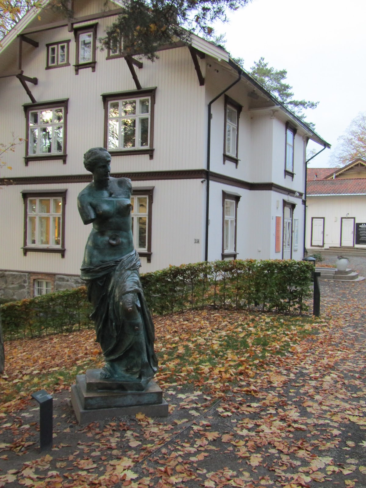
Venus de milo aux Tiroirs by Salvador Dali. 

The park also hosts different concerts and events throughout the year, in addition to guided tours to learn more about the sculptures.

Distant view of Auguste Rodin's Cariatide Tombee á Lúrne.

Gamle Oslo and Ekebergparken blend the old with the new, to give a taste of how the landscape in Oslo has changed over thousands of years. Tusen takk for a great afternoon!